كازاخستان
Summary
The article deals with the overland corridors of the Silk Roads that were passing through the territory of modern Republic of Kazakhstan.The author is a research fellow at a private scientific and research organization, called, “Archaeological Expertise” based in Almaty, Kazakhstan, and is the national focal point for UNESCO Silk Road Online Platform. This Article was entirely written in English. It covers the period from VIII-II centuries BC to XVIII century and follows the period of functioning of some historical urban centers along the Silk Roads from the territory of modern Kazakhstan.
Words for access to the article for online search engines: Kazakhstan, Silk Roads, Silk Way, Chang’an – TianShan Corridor, Syrdarya Corridor, Saryarka Corridor, Mangyshlak or Ural – Caspian Sea Corridor, Prehistory of the Silk Roads.
* International transliteration standard ISO-9 was used in present article for transliteration of the names of consulted literature from Cyrillic characters to Latin characters. Translation of the names of consulted literature in Cyrillic characters to English marked in round brackets and was made by the author of the article.
1. Introduction: Historical links between Kazakhstan and the Silk Roads
From the geographical point of view the territory of modern Republic of Kazakhstan is situated in the middle of historical corridors of the Silk Roads. From the commonly known beginning of the history of the Silk Roads in the III-II century BCE the territory of modern Republic of Kazakhstan was one of the first areas, which experienced the influence of the first commercial and cultural contacts with civilizations situated far from the Central Asian region. As a consequence, detailed description of all historical links between Kazakhstan and the Silk Roads require a serious complex scientific research, which will be far too long for this contribution. Caravan routes or the corridors of the Silk Roads were a unique instrument of transmission of economic, linguistic, cultural, religious, military and political values and innovations between different civilizations across the Eurasian continent. Only military conquests and migrations of nomadic communities on the territory of Eurasia have a comparable short-term influence on these types of inter-civilization exchanges until the modern era of globalization2.
According to Professor K.M. Baipakov – leading national specialist on the Silk Roads, there are two main stages of the functioning of the Silk Roads. First stage could be identified as “Proto-Silk Roads” and was related to formation of such states in Central Asian as Bactria, Khorezm, and Saka State in Zhetysu and Aral Sea region, which established first close contacts with China and Iran. This stage covers the period from VIII to II centuries BC. Second stage begins with the famous diplomatic trip of Zhang Qian in 1383.
As for the human societies that were living on the territory of modern Kazakhstan, we can talk about constant and persistent importance of the contacts along the Silk Roads for development of local economy and their international contacts. In spite of the rise and decline of particular civilizations and states, military conflicts and expansions, population movements, natural disasters and climate changes from the Antiquity to the end of Modern period, the role of the Silk Roads were never marginal for Central Asia – the region, which had no access to maritime commerce due to its geographical location in the middle of Eurasian continent and which had never experienced the influence of so-called Age of Discovery.
To give a global vision of what are the Silk Roads in Kazakhstan, the present article is going to present, at first, the corridors of the Silk Roads that were passing through the territory of country and then the main urban centers that were functioning on it.
At the same time it is important to understand that the system of Silk Roads was only a part of a larger network of commercial and inter-cultural contacts on the huge territory of Central-Asian region.
Urban centers along the Silk Roads were first of all giant regional political and economic centers situated in the most favorable climatic and strategic geographical areas. These centers were never relying from the economical point of view only on the Silk Roads, but they were regional “conductors” that all together were making possible the functioning of Silk Roads as more global system.
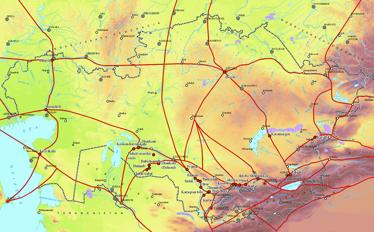
Description of most of these sites is going to be accompanied by a brief description of the archaeological excavations and revealed findings on its territory that demonstrate in its turn all above-mentioned inter-cultural exchanges that were taking place in the past. All the descriptions of the corridors and historical and cultural sites along the Silk Roads are followed by maps and photos that were provided by private scientific and research organization “Archaeological Expertise”. Each description of the urban centers of Kazakhstan situated on the Silk Roads is also followed by a short list of scientific publications that provides a better understanding of site’s history and the history of its explorations by archeologists.
2. Corridors of the Silk Roads on the territory of Kazakhstan
From hundreds of thousands historical and cultural sites situated on its huge territory, the Republic of Kazakhstan has proposed several of the most important and valuable ancient and medieval urban centers for the nomination as a part the Serial Transnational Nomination “Silk Roads” for UNESCO World Heritage List. All these sites are the remains of ancient settlements and necropolises. Eight sites from the initially proposed list were included into UNESCO World Heritage List in 2014 as part of the Serial Transnational Nomination “Silk Roads: the Routes Network of Chang’an – TianShan Corridor”. All other sites were originally separated among four categories (Syrdarya Corridor, Saryarka Corridor, Mangyshlak or Ural – Caspian Sea Corridor and Prehistory of the Silk Roads), which were all included into UNESCO World Heritage Tentative List of the Republic of Kazakhstan.
It is also important to mention that the above mentioned vision of the corridors of the Silk Roads is not final. New research works and consultations during the Coordination Committee of the Serial Transnational Nomination Silk Roads can identify new corridors and include new sites into the original composition. Revealing of new historical sources and new archaeological excavations that annually happen on the territory of most of these sites could also determine new sites and corridors that will become part of the Serial Transnational Nomination Silk Roads.
- Silk Roads: the Routes Network of Chang’an – TianShan Corridor
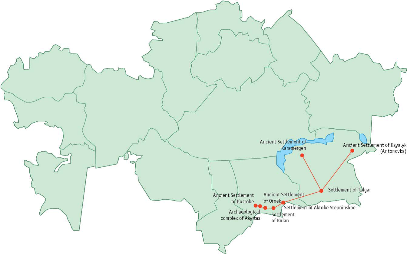
Serial Transnational Nomination was jointly prepared by People’s Republic of China, Republic of Kazakhstan and Kyrgyz Republic. During the 38th session of the World Heritage Committee (Doha, Qatar, 15-25 June 2014) present nomination was included into the UNESCO World Heritage List by becoming the first corridor of the Silk Roads that was successfully included in the List. The nomination is presented by eight sites of the Republic of Kazakhstan: Aktobe Stepninskoe, Akyrtas, Karamergen, Kayalyk, Kostobe, Kulan, Ornek, and Talgar.
“This property is a 5,000 km section of the extensive Silk Roads network, stretching from Chang’an/ Luoyang, the central capital of China in the Han and Tang dynasties, to the Zhetysu region of Central Asia. It took shape between the 2nd century BC and 1st century AD and remained in use until the 16th century, linking multiple civilizations and facilitating far-reaching exchanges of activities in trade, religious beliefs, scientific knowledge, technological innovation, cultural practices and the arts. The thirty-three components included in the routes network include capital cities and palace complexes of various empires and Khan kingdoms, trading settlements, Buddhist cave temples, ancient paths, posthouses, passes, beacon towers, sections of The Great Wall, fortifi cations, tombs and religious buildings.”4
b. Syrdarya Corridor of the Silk Roads
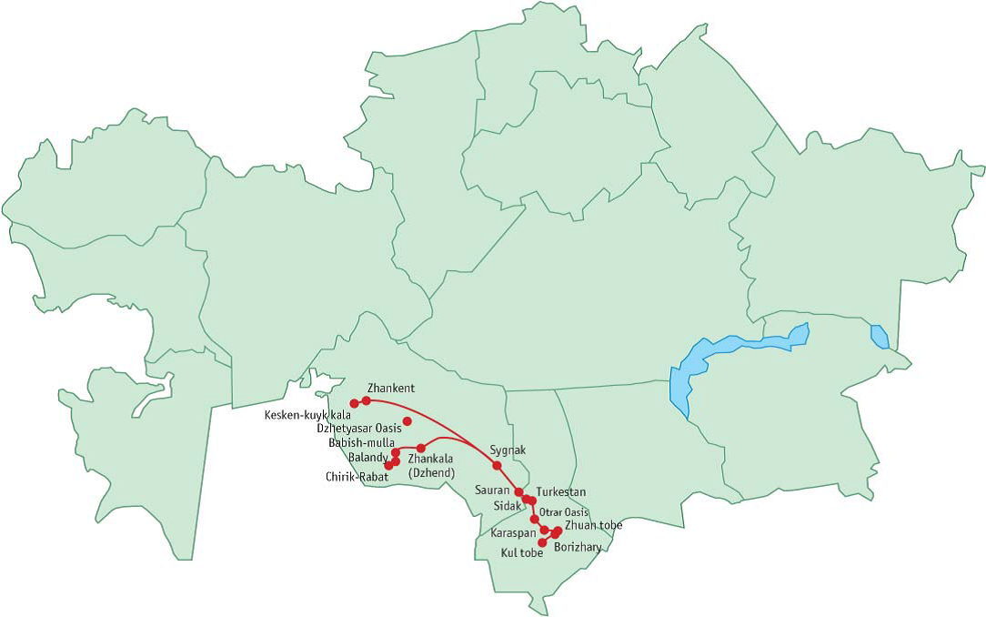
Only one site of Bozok was originally included into the nomination.
Sixteen sites of the Republic of Kazakhstan were originally included into the nomination: Babishmulla, Balandy, Borizhary, Chirik-Rabat, Dzhetyasar Oasis, Karaspan, Kul tobe, Kuyuk-kesken kala, Otrar Oasis, Sauran, Sidak, Sygnak, Turkestan, Zhankala or Dzhend, Zhankent, Zhuan tobe.
“Syrdarya part is marked by well-preserved rests of cultural landscapes of oasises and towns saved in conditions of present steppe, desert a semi-desert area and adjusted to big water arteries (Chu, Syrdarya, Arys, Bugun).
In western direction from Ispidzhab caravan road lead to Arsubaniket on Arys river, to Otrar (Farab), and then down Syrdarya - in Priaralye. On Syrdarya part, the biggest towns were Otrar (Farab) and town of Otrar oasis, Yassy (Turkestan), Shavgar, Sauran, Sygnak, towns of Dzhetyasar oasis, Dzhent, Dzhankent, Khuvara. From Dzhankent the road went to north-eastern side, came to the banks of Beleuty river and lead to Kounrada, Karasakpay region.”5
c. Saryarka Corridor of the Silk Roads
Only one site of Bozok was originally included into the nomination.
“Saryarka part laid on the territory of the “Great Steppe” of the Central Kazakhstan – Desht-I Kypchak. Monuments of this region bent for many small rivers, Ulytau foothills, banks of Ishim, Nura, Sarysu, Irtysh. Sarysu path lead to the Central Kazakhstan: from Otrar through Shavgar and Turgay pass on Aksumbe, it went to the lower Sarysu and up along the river to Ulytau, and from there to Ishim along Irtysh. The shorter path went through Suzak to the Lower reaches of the Chu, and from there – through Betpak-Dala desert – to Dzhezkazgan region. One more road “Khanzhol” was used till present time: it was from Taraz down along Talas through Muyunkum and Betpak-Dala sands to the banks of Atasu river.
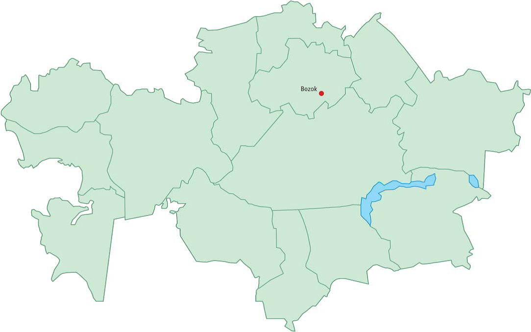
According to the data of Tamim ibn Bakhra and al-Idrisi, there was a trade path to Kimaks in Irtysh from Taraz through Adakhkes and Dekh Nujikes towns. Ili valley connected with the Central Kazakhstan by the road which went along north slopes of Chu-Ilii mountains, then along Chu river in its lower reaches to the Sarysu banks, and also northern Ili route, described above. From northern Ili road, which lead to Djungar gates, there was a direction, rounded Alakol from western side and through Tarbagatay lead to Irtysh – to the land of kimaks state with the Bandzhar, Khanaush, Astur, Sisan and “capital” of khakan. On Ishim river these roads lead to Bozok town then lead to the north and west.”6
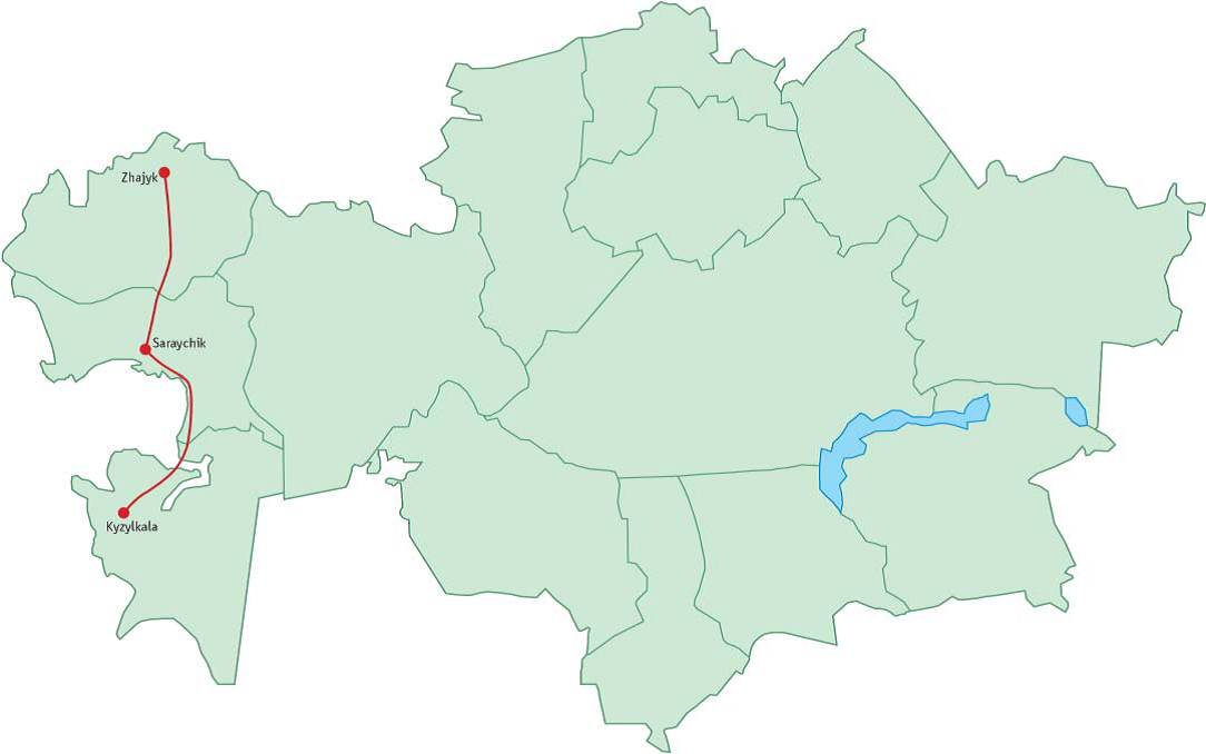
d. Mangyshlak or Ural – Caspian Sea Corridor of the Silk Roads
Three sites of the Republic of Kazakhstan were originally included into the nomination: Kyzylkala, Saraychik, Zhayik.
“Mangyshlak (Uralo-Prikaspiyskiy) part of the Silk Roads, located along eastern bank of the Caspian Sea, situated in essential natural landscape of deserts and semi-deserts, differentiated by wide diversity of its natural complex and extremal climatic and natural conditions”. Population of these regions was a conglomerate of nomad and cattle-breeding tribes, who controlled trade roads, adjusted to the system of wells, springs, small rivers, what had influenced on material monuments of the culture of the region. It was possible to reach lower Ural and Volga from Urgench, following the road of Ustyurt caravanserais. On this part of the road there was situated Kyzylkala town. Passing by the territories of Southern and Northern Priaralye the trade arteries lead to the towns on Ural. (Zhaiyk) river: Saraichik and Zhaiyk towns. Then they lead the caravans to the western direction-to the Europe, Crimea and Caucasus, and also to the “Zhaiyk road” to the Esatern Priuralye, Ural and Povolzhye.”7
e. Prehistory of the Silk Roads
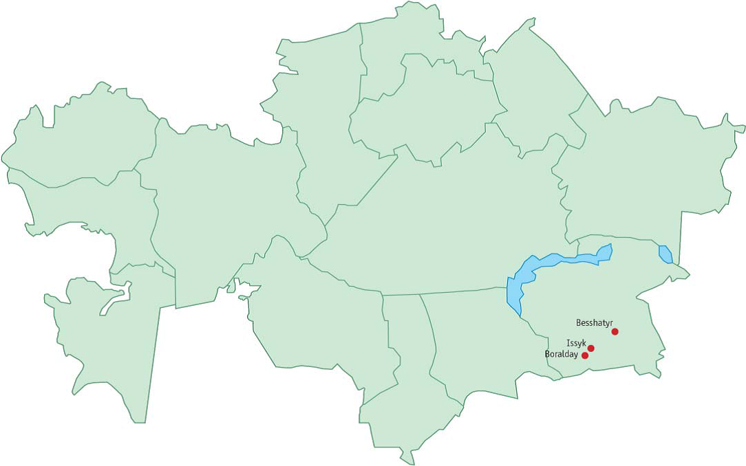
Three sites (necropolis) of the Republic of Kazakhstan were originally included into the nomination: Boralday, Issyk, Besshatyr.
3. Historic cities and other sites of Kazakhstan on the Silk Roads
The information on further cities and other sites of Kazakhstan on the Silk Roads is presented according to the order of above mentioned corridors of the Silk Roads that pass through the territory of the country. Present article includes only the presentation of nominated sites as part of the Serial Transnational Nomination “Silk Roads” because on the national level they are considered as the most valuable sites of the Silk Roads. However, as it was mentioned before, present list is not final and could be enlarged in the very near future.
- “Silk Roads: the Routes Network of Chang’an – TianShan Corridor”
Aktobe Stepninskoe (beginning of VI – XIII centuries)

Settlement of Aktobe Stepninskoe is an archaeological site situated on both sides of Aksu River in the middle of the steppe area of Zhetysu Region. Central part of the settlement is situated on the left bank. The site stands on the rectangular elevated area of 15 meters in height. The central part of the city (shakhristan) was situated on the area of 240x210 meters is size and was surrounded by two walls of 17 and 25 km. Excavation work have revealed numerous ceramic, bronze and iron findings, and about 5 000 copper coins of Karakhanid period. Most of revealed structures stand along the river.
Akyrtas (V century BC – XVIII century)
The archaeological complex of Akyrtas is an example of the Middle Eastern architectural style in Central Asia. The palace of Akyrtas was built by Arabic architects with the use of their traditional construction techniques. Due to this fact the architectural style of the central palace is similar to the same constructions of Iraq, Jordan, and the Palace of Qasr al-Khaiyar al-Gharbi in Homs, Syria, in particular. The site is situated in the area of Kyrgyz Alatay Mountains in 40 km from the modern city of Taraz. It includes numerous constrictions from the V century BC to XVI-XVII centuries. The size of the central complex is about 3 km from the east to the west and 5 km from the north to the south.
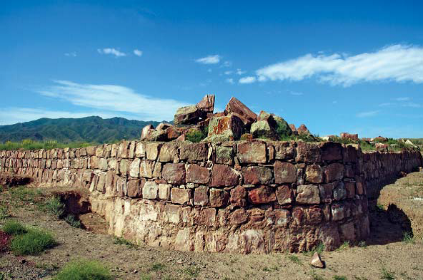
It includes the palace complex and its adjacent area on both sides of now dry river valley. This compact area counts several caravanserais of XI-XIV centuries. One of the distinctive particularities of the site is the local water collection system with its water reservoirs, irrigation systems and ditches.
Karamergen (IX-XIII centuries)
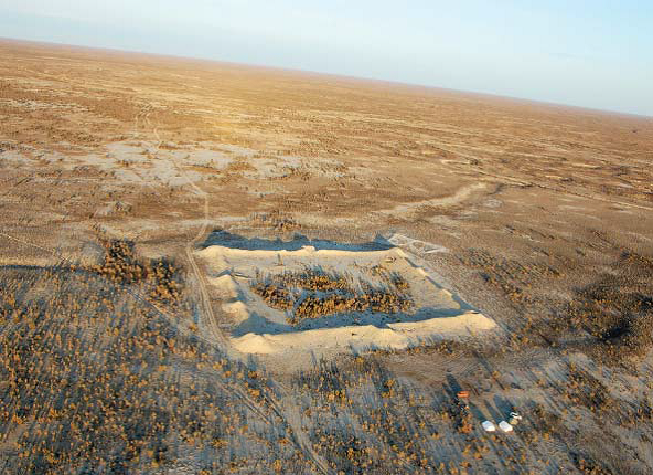
The settlement of Karamergen is situated on the south of Balkhash Lake in 200 km from the village of Bakanas. The site is situated on the elevated area of 1, 5-2 meters in height between sandy ridge and ancient river valley. It is a fl at rectangular area of 115x120 meters in size. Height of walls was about 4, 5 meters.
Kayalyk (XI-XIII centuries)
The settlement of Kayalyk was the largest urban center of the Ili valley situated on the banks of the Ashybular River in 190 km from modern city of Taldykurgan. The city was mentioned in the sources of XI-XIII centuries as a capital of Karluk’s “dzhabgu” – an independent possession of Turkic Karluks in Karakhanid Khanate. The city was visited in the middle of the XIII centuries by Guillaume de Rubrouck, an ambassador of Louis IX the King of France on his way to Mongolia. He described the city as an important trading center. Archaeological excavations have revealed two mausoleums, one Buddhist temple, and one mosque on the territory of the site.
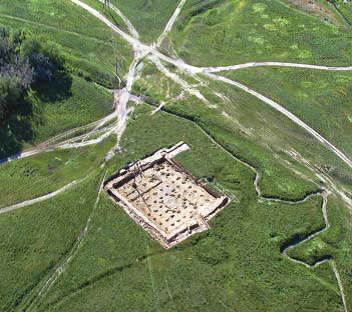
Kostobe (IX-X centuries)

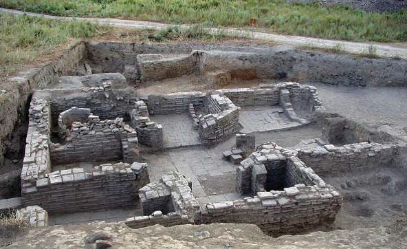
The settlement of Kostobe is located on the east of the village of Sarykemer on the right bank of Talas River. It was a major cultural, commercial and manufacturing center of the southern part of Zhetysu region. Central part of the city has a rectangular elevated area of 420×450 meters in size. The city was surrounded by a double wall line with towers. According to written sources the origin of the settlement is related to Sogdian migration from the area of the city of Bukhara to the Valley of Talas River. An important part of the citadel was occupied by a palace and a temple complex. Topography of the city shows its similarity to other cities of the Valley of Talas River such as Ak-Beshim or Krasnaya Rechka on the territory of Kyrgyz Republic.
Kulan (VIII- XIII centuries)

The settlement of Kulan is mainly known from written Chinese and Arabic sources of VIII-XIII centuries. In the text of the pilgrim Zhang Qian it was mentioned as “Tzuilan”. The territory of the site includes numerous remains of fortifi cations and residential districts of different periods located at the same area. Revealed constructions belong to Turkic and Sogdian cultures; particular place among them occupies the Zoroastrian fi re temple and the big bazaar, which underlines the important place of the settlement of the steppe trading itineraries of the Silk Roads.
Ornek (VIII–XII centuries)
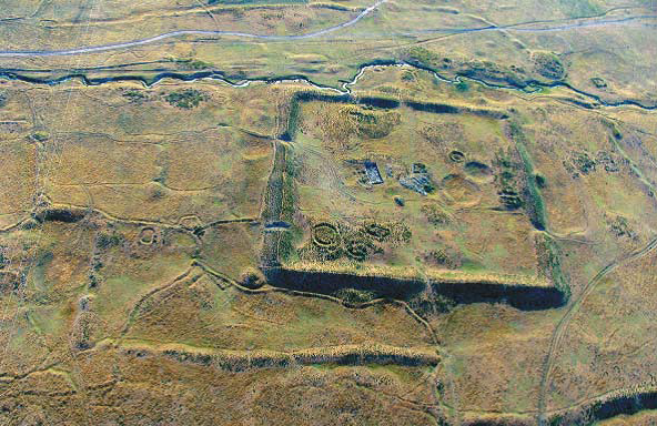
The settlement of Ornek that correspond to the ancient settlement of Kulshub is situated in 8 km from the modern village of Ornek on the banks of the rivers of Altynsu and Shybyndy. The city was surrounded by fortification structures and 31 towers. Archaeological excavations have shown that the city was an important trading center between urban and nomadic communities of the region. The city was originally established as a headquarters of Ancient Turkic nomads that was transformed into a big city on the Silk Roads. Nomadic necropolis near the city shows that it was situated on the way of seasonal nomad migrations between summer and winter pastures. In this regards the development of the city into a big trading center was related to its interactions with nomadic communities.
Talgar (VIII-XIV centuries)
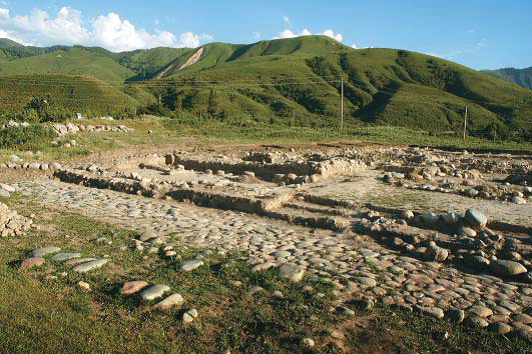
The settlement of Talgar is situated on the south of modern city of Talgar on the right bank of Talgar River. The site has a rectangular form surrounded by walls with towers and a bitch. Each wall has about 300 meters in length and has en entrance in the middle. The artifacts that were found in the city, such as inscriptions in Turkic, Arabic, Chinese and Kidan characters, confirm that it was an important medieval trading center on the Silk Roads. The architectural style of the settlement is characterized by wide usage of stone as construction materials, and large amount of big yards that correspond to cattle breeding farms.
b) Syrdarya Corridor of the Silk Roads Babish-mulla (IV-II centuries BC)
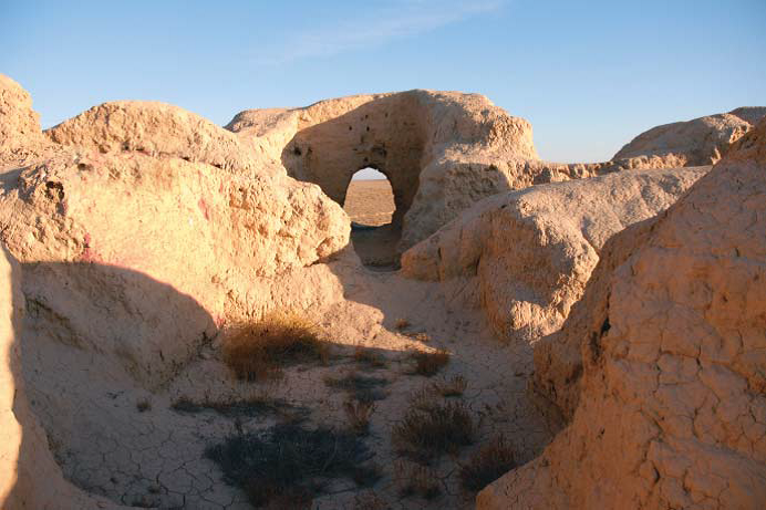
The settlement of Babish-mulla is situated in 40 km the settlement of Chirik-Rabat. This complex includes two sites – the settlement Babish-mulla 1 and the burial construction Babish-mulla2. The central irrigation channel starts in 6 km from Babish-mulla 1, which was much smaller than the settlement of Chirik-Rabat.
Balandy (IV-II centuries BC)
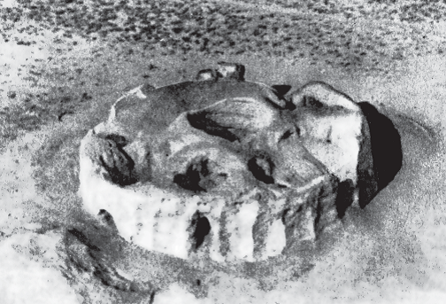
The ancient complex of Balandy includes a fortress and two mausoleums situated at 40 km from Chirik- Rabat on the territory of Aral Sea region. Archaeological excavations have shown the mausoleums were seriously devastated during the Antiquity. However, they revealed a few burial chambers. On the adjacent area of the complex another 18 mausoleums were identified.
Borizhary (second half of VII – VIII centuries)
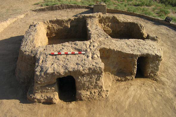
The necropolis of Borizhary is the biggest necropolis of southern Kazakhstan region situated on the left bank of Arys River of 13 km in distance. The length of the territory of necropolis sometimes goes up to 1-2 km. The bank the river is covered by hundreds of kurgans that form a single are of necropolis. Total are of the site is about 2100 hectares. Scientifi c explorations of this territory have shown that is diffi cult to establish any connection between sites situated far from each other. It is possible that the territory of the necropolis is even bigger because some single kurgans are situated beyond the main territory. Geophysical research works have shown that 2 386 kurgans are situated on the territory of the necropolis in total.
Chirik-Rabat (V-II centuries BC and XII century)
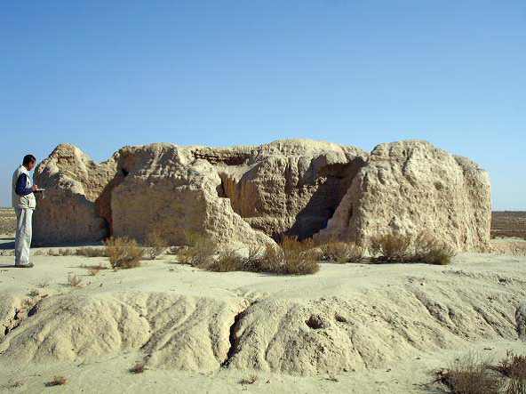
The settlement of Chirik-Rabat is situated in 300 km from the modern city of Kzylorda in the middle of the desert of Kyzyl-kum and was discovered in 1940s. The territory of the ancient city is situated on the elevated area of oval form, which has 850 meters in length and 600 meters in width. Archaeological excavations have revealed a two fortifi cation systems of different periods: V-II centuries BC followup by a short period in XII century. The city was surrounded by a ditch of 40 meters in length and 4,5 meters in depth with a strong walls and towers. Next the settlement were situated a few heavily devastated kurgans and burial constructions.
Dzhetyasar Oasis (III-IX centuries)
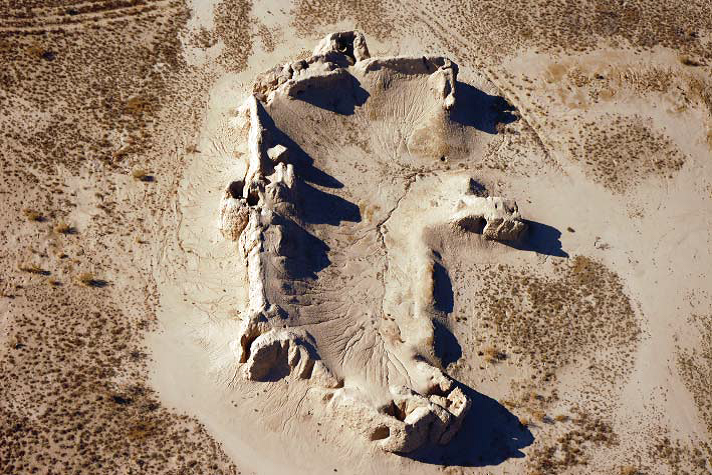
The territory of Dzhetyasar is situated on lower banks of Syrdarya River and represents a unique concentration of ancient settlements and necropolises of Dzhetyasar culture, which could be associated to the population of Kangju state. All settlements on this area are the compactly populated fortified castles. These settlements were surrounded by numerous necropolises (740 kurgans in total), which have revealed numerous very interesting findings such costume fragments, ceramics etc.
Karaspan (XVI-XVIII centuries)
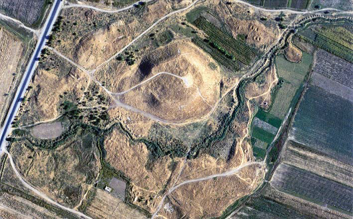
The name of the ancient settlement of Karasaman (modern Karaspan) situated in the valley of Arys River appears in historical sources in XVI century. The size of the central part of the ancient city is 220×260 meters in size. The total size of the site remains unknown because of modern agricultural and construction works. Archaeological excavations on the territory of the central part of the city have revealed a collection of coins of XVI-XVII centuries that dates the upper layers.
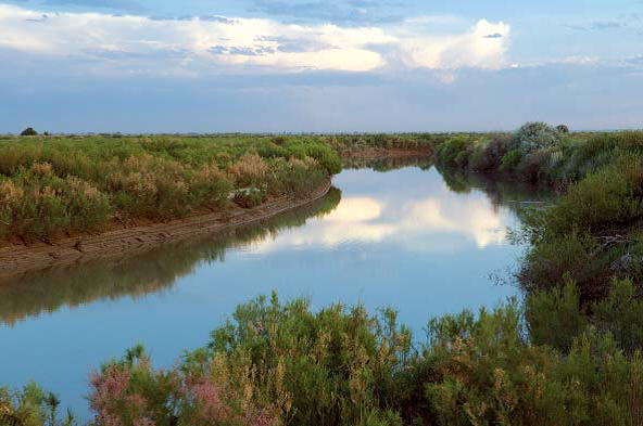
Arab sources of X century identify the settlement as a relatively small city situated in the mountain area of Talas valley. The ancient settlement is also known as Aktobe Orlovskoe. It was an object archaeological excavations that have identified the period of its functioning.
Kesken-Kuyuk kala (X-IX centuries)
Kesken-Kuyuk kala or the settlement of Dzhuvara was mentioned for the first time under the name of Khavrana in IV century by Ammianus Marcellinus. It is the biggest explored settlement situated on the southern bank of now dry valley of Syrdarya. The city was surrounded by a wall, which now has about two meters and has a citadel, which has 210×210 meters in size. Archaeological excavations have revealed two construction periods: first – X-XII centuries and second – VII-IX centuries. Early constructions were almost entirely destroyed, while late constructions have shown numerous big houses and streets. On the territory of the site, archeologists have found Turgesh, Tang, Khorezm and Bukharin coins, and copper belt plaques that show commercial links of the city with foreign cultures.
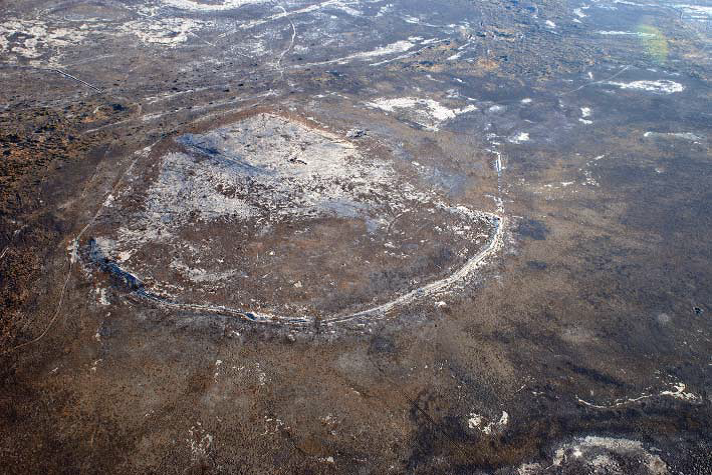
Otrar Oasis (III-XVIII centuries)
On the north the Otrar oasis is situated near the Turkestan and Tashkent oases. The oasis includes several such settlements as Buzuk, Oliktobe, Aysentobe, and Aykol. The total surface of the oasis counts 53 km from the north to the south and 54 km from the west to the east. Different settlements of the oasis form several micro-oases. The largest among them is situated around the city of Otrar. Some of these sites start to form around III-IV centuries. In XII-XV centuries most of them became marginal, while Otrar was functioning until the XVIII century. Total area of Otrar oasis counts 136 different sites. In modern days the old irrigation system is widely used by local community. This fact has a negative impact on the historical sites because of the destructions related to modern development of the agriculture.
Sauran (XII-XVIII centuries)
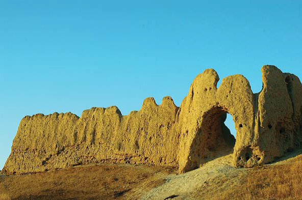
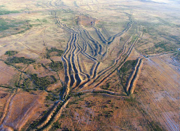
First reference to the settlement of Sauran dates by the X century. However, the location of the settlement in pre-Mongol period refers to the settlement of Karatobe situated in 3 km from late Sauran. In XIV century the city was the capital of the state of Ak-Orda. At all times Sauran was known for its strong fortifications and a madrasah of XVI-XVII centuries with minarets of 15 meters in height. One of particular characteristics of the settlement of Sauran is the system of irrigation channels (kyariz) that became clearly visible on the aerial photos of the territory near the settlement.
Sidak (V-XII centuries)
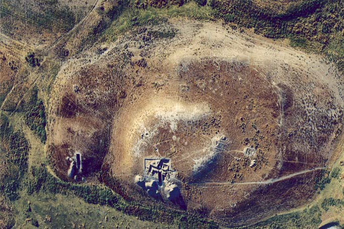
The settlement of Sidak is situated in 18 km from the modern city of Turkestan and represents a typical settlement of the early medieval period. The central part of the citadel was occupied by temple complex. One of the main characteristics of the city is the numerous signs of the form of “tamga” of the medieval period maid on the ceramic objects. According to professor Baipakov the population of the settlement of Sidak was a temple community. Their main occupation was the conservation of remains of the ancestors and organization of sacral ceremonies.
Sygnak (X-XVIII centuries)
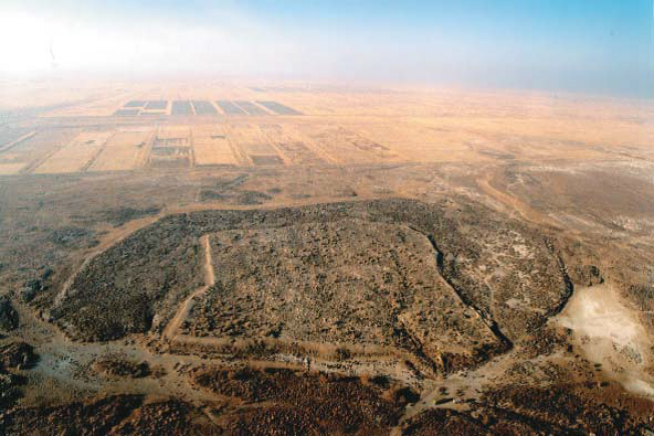
The settlement was mentioned for the first time in the historical sources of X century. From the XII century, the city was the capital of Kypchak State. In 1219 during the Mongolian invasion the city was heavily damaged. After a long period of regression after the seizure of the city by Mongol army Sygnak becomes the political center of Ak Orda State only in the second half of XIV century. In XVI-XVIII centuries the city was governed by Kazakh rulers and was the biggest urban center of the lower Syrdarya region. Short history of the settlement shows its strategic position on the frontier of the great steppes of Central Asia, between the traditional location area of nomad and sedentary communities.
Turkestan (VIII-XIX centuries)
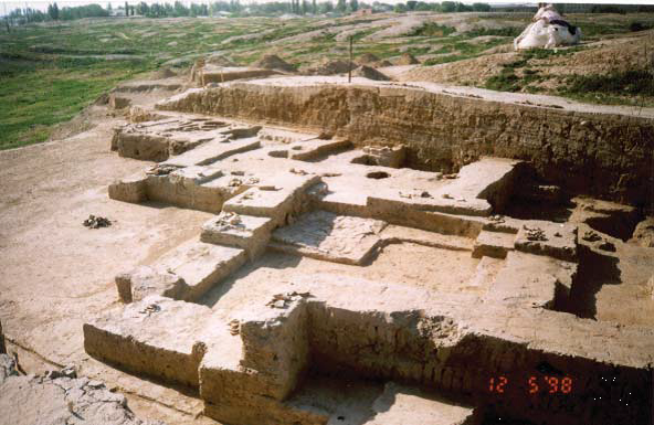
The settlement of Turkestan (Shavgar in VIII century and Yassu after XII century) was the capital of the wide Turkestan oasis. In XII century, the city became particularly know because of the Islamic saint – Khoja Ahmed Yassawi. The settlement is situated in the center of the modern similarly-named city. The citadel in the north-western part of the city was surrounded by the first wall, while the total area of the city was about 35 hectares. According to archaeological sources the settlement continued to function up to XIX century. In the Middle Ages the city was the capital of Timurid and Sheidanid rulers, as well as Kazakh khans. During all its history the settlement was a center of Muslim spiritual life, and an important commercial and agricultural center on the Silk Roads.
Zhankala or Dzhend (X-XVI centuries)
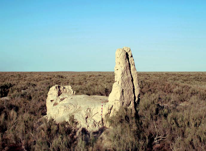
The settlement of Dzhend situated in 6 km from the valley of the Zhanadarya River knew its most prosper period in X-XIII centuries. After been taken by Mongol troupes of Jochi, it became their headquarters. According to numismatic findings it continued to mint its coins even in XIVXVI centuries. Archaeological excavations of 1940s, 1950s and 1960s have formed a new dominating scientific opinion that the big settlement of Zhankala could be associated with the medieval settlement of Dhzend. The central part of the settlement was surrounded by walls of 5 km in length. Among archaeological findings on the territory of the settlement there were silver and copper coins. However no pre-Mongol coins were found during these excavations.
Zhankent (I-X centuries)
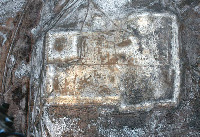
The settlement of Zhankent or Yangikent was the center of so-called “swamp settlement” situated on the territory of now dry part of Aral Sea near modern city of Kazalinsk. In X century, Ibn Hawqal identifies the city of Yangikent as a capital of Oghuz state and as the biggest settlement on the territory of lower Syrdarya of that period. Strategic disposition of the city, close to some sedentary oasis of Central Asia, explains the decision to establish there the capital of Oghuz rulers. The territory of the settlement had almost rectangular form and an elevated central area of 100x100 meters and was surrounded by a wall that now has about 8 meters.
Zhuan tobe (I-IX centuries)
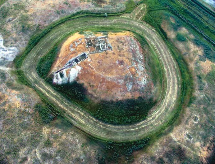
The settlement of Zhuan tobe is well known among the archeologists from the 1950s. The settlement situated near the territory of the necropolis of Borizhary. Ceramic fragments are the main archaeological findings maid on the territory of the site. A high concentration of a few settlements shows the importance of this area to the development of the commerce on the Silk Roads. The settlement has a double structure: central part represented by an elevated area and a few kurgans that form a circle around the central part. Total area of the city has 380x380 meters in size.
c) Saryarka Corridor of the Silk Roads
Bozok (X-XII centuries)
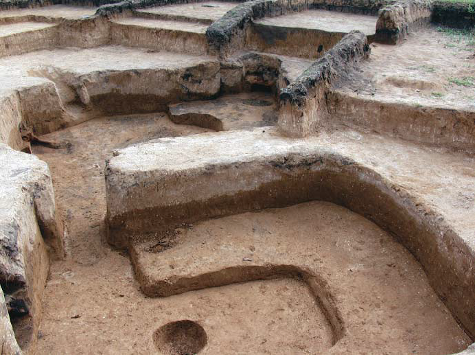
The medieval settlement of Bozok is a recently discovered settlement near the capital of modern Kazakhstan – the city of Nur-Sultan (Astana). The original name of the city remains unknown and the name of Bozok refers to the name of the lake situated near it. The settlement dates by the period, when this territory was a part of Kypchak state in the pre-Mongol period. The city stands on the eastern side of the lake and counts three districts surrounded by a wall and a few ditches. Archaeological excavations have revealed a few houses with several premises inside each of it.
d) Mangyshlak or Ural – Caspian Sea Corridor of the Silk Roads
Saraychik (XIII-XVI centuries)
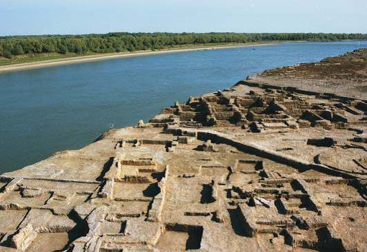
The ancient settlement of Saraychik is situated on the right bank of Zhayk River in 55 km from modern city of Atyrau. It was founded in the middle of XIII century by Batu khan (1227-1256) on the strategic place between Europe and Asia. Numerous historical sources mentioned the city as important commercial center on the Silk Roads and political center of such states as Golden Horde, Mangyt Urt and Nogai Hodre. In 1580 the city was destroyed by Kazak troupes, which was the start of its end. Urban style of the city shows its connections with the urban center of Aral Sea and Syrdarya regions.
Zhayik (XIII-XIV centuries)
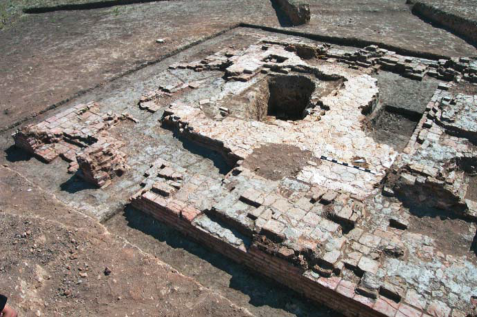
The ancient settlement of Zhayik is situated in 10 km from the modern city of Uralsk on the right bank of the Ural River. The square of the site is between 7 and 9 hectares. Historically the city didn’t have any defensive fortifi cations. Analysis of the plans and construction techniques of the settlement have shown that they have experienced the influence of construction traditions of Khorezm and cities of Syrdarya oases. One of the main archaeological discoveries made on the territory of the settlement was the remains of the big baths, which shows the regional importance of the settlement as a big urban center. This fact was also proved by revealed ceramic fragments and coins.
e) Prehistory of the Silk Roads
Boralday (VIII century BC – III century)

The necropolis of Boralday includes numerous kurgans; some of them are huge (up to 20 meters high and 120-150 meters in diameter). It is one of the biggest kurgan complexes on the territory of all Kazakhstan. The site has 3 km in length and 800 meters in width. Most of kurgans were quiet well conserved because of the absence of modern constructions in their proximity. Kurgans were built by Saka (VIII-III centuries BC) and Wusun tribes (III century BC – III century). The site has potential to be transformed into the archaeological park and ethnopark in the near future.
Issyk (IV-I centuries BC)
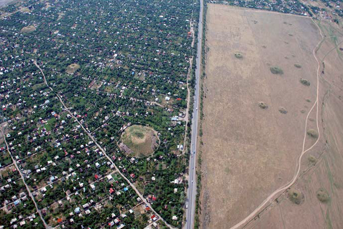
Giant necropolis of Issyk is situated on the west of modern city of Issyk and counts over 40 kurgans. The biggest kurgan has 6 meters in height and about 60 meters in diameter. Archaeological excavations on the territory of only one biggest kurgan have revealed about 4000 golden objects of Saka period and the most important archaeological finding of Kazakhstan – so-called “Golden Man”, which was situated inside of one of secondary burial chambers. The territory of site is now situated under the authority of State’s Historical and Cultural reserve-museum “Issyk”.
Besshatyr (V-IV centuries BC)

The territory of necropolis is situated on the right bank of Ili River and includes 31 kurgans. One of three biggest kurgans has 104 meters in diameter and 17 meters in height. Archaeological works on the territory of the site have shown some minor archaeological findings such as a few daggers and arrow heads and some previously unknown construction techniques. Total square of the site is about 2 km, however, some of related sites are situated even in 5 km from the central part of the site. Necropolis was built by Saka tribes of Zhetysu (Valley of Ili River).
4. Publications on the Silk Roads
2010
Voyakin D.A., Pachkalov A.V. Monetnye nahodki na gorodiŝe Džan-kala// Istoriko-kul’turnoe nasledie aralo-kaspijskogo regiona. Materialy II meždunarodnoj naučno-practičeskoj konferencii [Coin findings of the settlement of Dzhan-kala// Historical and cultural heritage of Aral and Caspian regions. Materials of second international scientifi c and practical conference]. Aktau, 2010. p. 55-63.
Baipakov K.M., Voyakin D.A. Karavan saraj Tortkol’// Mir putešestvij Kazahstana [Caravansary of Tortkol// World of Travels of Kazakhstan], Almaty, 2010. September – October. p. 22-25.
Baipakov K.M., Voyakin D.A., Umarkhodzhiev A.A. Issledovaniâ gorodiŝa Džend// Izvestiâ NAN RK [Studies of the ancient settlement of Dzhend// Journal of Academy of Sciences of the Republic of Kazakhstan], 2010. №1. p. 100-123.
Baipakov K.M., Voyakin D.A. Sogdijcy srednevekovogo Kaâlyka// Promyšlennost’ Kazahstana [Sogdians of medieval Kayalyk], Almaty, 2010. № 3 (60). p. 94-98. Baipakov K.M., Voyakin D.A. Goroda Bostočnogo Priaral’â: Džend, Asanas, Barčkent// Promyšlennost’ Kazahstana [Cities of Eastern Aral Sea Region: Dzhend, Asanas, Barchkent], Almaty, 2010. № 2 (59). p. 96-98.
2011
Baipakov K.M., Voyakin D.A. Kazahstanskij otrezok Velikogo Šelkogo puti v serijnoj nominacii ÛNESKO// Svideteli tysâčeletij: arheologičeskaâ nauka Kazahstana za 20 let (1991-2011). Sbornik naučnyh statej, posvâŝennyj 20-letiu Nezavisimogo Kazahstana [Kazakh section of the Greal Silk Way in UNESCO Serial Nomination// Testifi ers of millenniums: archaeological science of Kazakhstan for 20 years (1991-2011). Journal of scientifi c articles dedicated to 20th anniversary of Independent Kazakhstan]. Almaty, 2011. p. 225-249.
Baipakov K., Voyakin D., Amanbaeva B., Kolchenko V., Sulaymanova A., Yakibov Y., Mukimov R., Khodzhaniyazov T., Kurbanov A., Gritsina A. Prominent Archaeological Sites of Central Asia on the Great Silk Road. Samarkand. IICAS, 2011. 134 pp.
Voyakin D.A. Islamic Archaeology of Kazakhstan and Problem of Dzhend Localization. Second International Conference on Islamic Archaeology. Islamabad, 2011. P. 28-29.
2012
Petrov P.N., Baipakov K., Voyakin D. Numizmatičeskie nahodki na gorodiŝe Antonovka (k voprosu o vremeni prekraŝeniâ funkionirovaniâ srednevekovogo goroda Kajlyk// Numizmatika Zolotoj Ordy. Sbornik naučnyh statej. Vypusk 2 [Numismatic fi ndings on the ancient settlement of Antonovka (question of the end of functioning of medieval city of Kayalyk)// Numismatics of the Golden Horde. Journal of scientific articles. 2nd number]. Kazan, 2012. p. 87-93.
Dawkes G and Voyakin D. The Medieval Citadel of Taraz, Kazakhstan// http://www.medievalarchaeology.co.uk/index.php/publications-2/journal/
J.S. Park, D.A. Voyakin. A Comment on High Tin Bronzes of Korea and Islamic Iran// Drevnosti Otrara i Otrarskogo oazisa, Kazahstana i Evrazii [Relics of Otrar and Otrar oasis, of Kazakhstan and Eurasia]. Almaty 2012. p. 368-375.
Vileikis O., Dumont B., Serruys E., Santana Quintero M., Van Balen K., Voyakin D., Tigny V., De Mayer P. The Silk Road World Heritage Nomination: Documentation and Monitoring with the Support of Geo-Content Management Systems// Proceedings of the 1st International Conference on Best Practices in World Heritage: Archaeology. Menorka, Spain, 9-13 April 2012. P. 1023-1036.
2013
Baipakov K.M., Voyakin D.A., Seitkaliev M.K., Buranbaev R.N. Nekotorye itogi issledovaniâ banihamam na gorodiŝe Taraz v 2012 g. Izvestiâ NAN RK [Some results of explorations of hamam-bath of the ancient settlement of Taraz in 2012], 2013. № 3. p.187-199.
Baipakov K.M., Kapekova G.A., Voyakin D.A., Mariashev A.N. Sokroviŝa drevnego I srednevekovogo Taraza i Žambylskoj oblasti [Treasures of ancient and medieval Taraz and Zhambyl Region]. Almaty, 2013. 320 p., in 3 volumes. (kaz., rus., engl.).
Zinyakov N.M., Savelieva T.V., Voyakin D.A. Kuznečnye i čugunnye izdeliâ srednevekovogo Tal’hira [Forged and iron objects of medieval Talkhir]. Lap Lamberg Academic Publishing, 2013. 480 p. (rus., engl.) Voyakin D.A. Archaeological Park as a Basis for Elaborating Principles and Objectives of Venice Charter// World Heritage. 2013. №69. P. 90-91. (engl., fr., esp.)
2014
Baipakov K.M., Voyakin D.A. Kazakhtan Section of the Great Silk Road in the Serial World Heritage Nomination. Almaty, 2014. 74 pp., ill.
Voyakin D.A. A Glimpse into the Silk Road: The Newest Archaeological Research and Cultural Heritage Policy Management at the City of Taraz// 20th Annual Meetıng of the European Assocıatıon of Archaeologısts 10-14 September 2014. Abstracts. Istanbul , 2014. P. 493.
K.M. Baipakov, D.A. Voyakin, Vydauŝiesâ arheologičeskie pamâpniki Kazahstana [Great
archaeological sites of Kazakhstan]. Almaty, Asyl Soz, 2014, 504 p.
Voyakin D.A. Another Revisit of the Question of Restitution or Return of Cultural Property to
Countries of Their Origin // Diplomatic Herald, 2014. 2 (45). p. 30-33.
Results of the UNESCO/Japanese Funds-in-Trust project “Support for documentation standards and procedures of the Silk Roads World Heritage serial and transnational nomination in Central Asia” 2011-2014// Composed by Voyakin D.A., Massanov M.N. Almaty, 2014, 164 p. (rus., engl.)
2015
K.M. Baipakov, Voyakin D.A., Ilin R.V. Kesken-kuûk kala – stoličnyj centr oguzov// Kazahskoe hanstvo v potoke istorii [Kesken-kuyuk kala – Oghuz capital center// Kazakh khanate at the fl ow of history]. Almaty, 2015. p. 214-228.
